


Coastal checks for climate effects
 Print
Print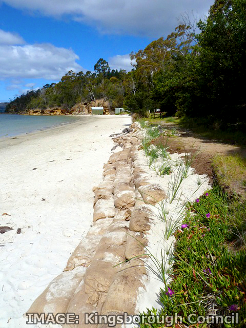 Tasmania’s long and stunning Kingsborough coastline is being used to study the effects of climate change on coastal communities.
The Kingsborough Council has been exploring and understanding natural hazards and climate change risks in its own backyard, conducting vulnerability assessments on its beaches and detailed case studies into natural hazards and climate change risks as well.
Experts found severe erosion putting pressure on car parks, roads and trees along the foreshore (which also provides habitat for the critically endangered Swift parrot), stormwater drains and public access to the beach.
Weather events and storm surges cause the erosion, but the experts say activities like parking dinghies along the shoreline contributes too.
The Council has started monitoring and mapping the erosion to identify where it is most likely to occur, and where protection efforts should be focused.
The studies explored nine risks to the community: bushfire, heatwave, tsunami, dam break, landslip, riverine flood, coastal inundation from sea level rise, storm surge and coincident flooding.
The project sought to quantify the exposure of the Kingston Beach assets, both structural and social, to those hazards.
It was undertaken by consultants from Climate Planning, with potential inundation modelling and mapping by Council staff.
The report came up with a number of adaptation options, resilient designs and alternative sea wall infrastructure responses, and other recommendations for the Council.
The Council says it hopes the project will serve as a template for other local government areas at risk.
The Council has also received a proposal to set up a Climate Change Innovation Lab, which the community leaders endorsed.
The proposed lab would allow researchers, Council staff, community and business figures to explore real-world applications and adaptations to climate change.
If it goes ahead, the lab will work with the Kingsborough Arts Hub to promote the ‘Art of Adaptation’.